The state's plans to expand Interstate 35, the busiest roadway in Austin and one of the most congested in Texas, would require expropriating land from almost 200 properties, according to a KUT analysis of schematic maps produced by the Texas Department of Transportation. Some property owners would cede a few square feet. Other tracts would be virtually wiped off the map.
TxDOT had already revealed that its top two options for the I-35 Capital Express Project — the name given to an overhaul of the highway between U.S. 290 East and Ben White Boulevard — would displace at least 140 properties. The state agency did not provide a list of each property affected, only maps in the form of large PDF files that require extensive zooming and scrolling to read.
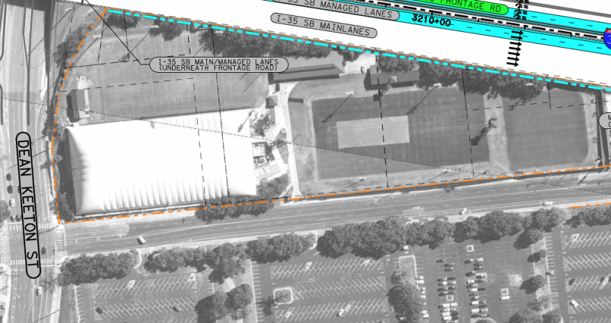
KUT examined maps from TxDOT's two leading options tract-by-tract. We created our own interactive map below showing each instance in which the right-of-way, a term to describe land where roads are built, would encroach into private property. For each property, we posted two screenshots to show how each of the leading "Build Alternatives" under consideration by TxDOT would incur on tracts of land.
Click here if you have problems loading the map on this page.
You can click on a point to bring up the images and property information from the Travis Central Appraisal District. To cycle through both images, click the small arrows at the bottom of each picture. This legend shows how to understand TxDOT's maps.

The dotted orange line represents the existing right-of-way (ROW). The dotted blue line illustrates the proposed new right-of-way. The dotted black line represents tract boundaries.
The Whip In, a convenience store and cafe on I-35 at Mariposa Drive, would concede more land under Build Alternative 2, for example, than Build Alternative 3.

That's the case for most properties affected by Build Alternative 2. That option would result in 32 acres of right-of-way being absorbed into the project, compared to 30 acres under Build Alternative 3, according to TxDOT's analysis.
In some cases, we counted adjacent tracts only once. For example, UT's Frank Denius Fields is actual made up of 10 interlocked tracts of land. All are owned by the university. Rather than add 10 points on the map, we added one to represent the entire facility.

TxDOT can use the power of eminent domain to expropriate property, but must pay the owner "fair market value" and, if applicable, help with relocation costs.
The agency considers the amount of right-of-way acquisition required by a project as one of several criteria in evaluating a preferred build alternative. But that's not the only criteria used to score the project. Build Alternative 1, which TxDOT has ruled out in part because of its $8 billion price tag — more than double the other two options — would actually claim about half as much right-of-way as Build Alternatives 2 and 3, about 16 acres.
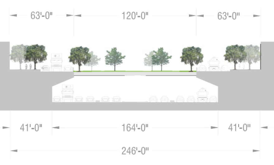
Three community-drawn alternatives to TxDOT's plans would work within the highway's existing footprint. TxDOT has largely discounted these plans either because they don't increase highway capacity, as with the Rethink35 proposal that would downsize the interstate to a boulevard, or because they include expensive features for which TxDOT will not pay, like the Downtown Austin Alliance/Urban Land Institute's proposal to bury I-35 by sinking it and putting multiple caps on top.

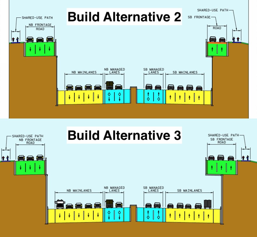
TxDOT argues its two leading proposals — which both include adding two lanes in each direction for vehicles with two or more passengers — meet the needs of the region's growing population. Both projects would remove the upper decks and lower the main lanes of the interstate.

Build Alternatives 2 and 3 would also increase pedestrian and bicycle infrastructure and aim to accommodate some of Capital Metro's plans for transit expansion under the voter-approved Project Connect plan.
TxDOT's plans are open to public comment until Friday, Sept. 24, an extension from the original deadline of last Wednesday. A final decision is expected in summer 2023. Construction is anticipated to start in late 2025.


