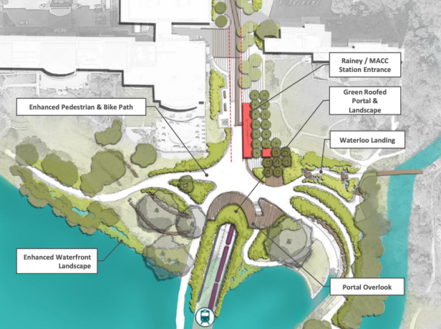
Facing pushback over plans to allow only light-rail and pedestrians on a new bridge over Lady Bird Lake, officials overseeing Project Connect, Austin's $7.1 billion transit expansion, are taking a closer look at whether to design the bridge so Capital Metro buses could cross into downtown.
The Lady Bird Lake Bridge is a key component of the Blue Line, one of two light-rail routes that are the most expensive parts of the voter-approved Project Connect transit buildout. The bridge would carry passengers into an underground tunnel beneath downtown Austin.

An analysis of the costs and benefits of allowing buses on the bridge is being conducted by the City of Austin, Capital Metro, hired consultants and the Austin Transit Partnership — a government agency created to oversee implementation of Project Connect.
The study is scheduled to be completed in April. A decision on whether to allow buses is expected by the end of May.
Transit planners were initially reluctant to allow buses on the bridge, citing concerns including increased costs, space constraints on the north side of the shore and the possibility that buses could increase the odds of a collision or obstruction on the tracks.

But a fierce debate over who will benefit from the single largest transit expansion in Austin's history convinced the Project Connect team to take a closer look at the possibility.
"Frankly, I think this is exactly what's supposed to happen during this process," said Peter Mullan, the chief designer at the Austin Transit Partnership. "We come in with a plan. We get feedback from it."
"I think this is a really important question that's been raised, and we need to study it," Mullan added.
Proponents of buses on the light-rail bridge argue that because Capital Metro's regular bus service primarily serves people of color and households with low incomes, banning buses would amount to racial and economic discrimination.
"To not have more opportunities, more pathways for people to cross the river, people that we know are predominantly people of color, is at best an equity issue, at worst just reliving the systemic racism that Austin has historically implemented," said Samuel Franco, a member of Austin's Urban Transportation Commission who has been a leading voice on opening the bridge to CapMetro bus routes.
But transit officials, while remaining open to the idea of buses on the bridge, insist the light-rail system will also benefit bus riders.
"[The Blue Line] is going to serve a lot of neighborhoods that have been historically lower income or higher percentage minority populations," CapMetro's Deputy CEO Dottie Watkins said. "So the presumption that light-rail is built for more affluent or whiter people, I think, is just a faulty assumption to start with."

Watkins said as a general rule, CapMetro wants as many dedicated paths for buses throughout the city as possible and could, in theory, reconfigure the bus network to take advantage of a new transit bridge.
"That service concept is what we're putting together right now to help us make this decision about what to do with the bridge," she said.
The Blue Line's route, which starts at Austin-Bergstrom International Airport, travels through predominantly Latino communities like Montopolis and down Riverside Drive.
But the demographics of the area have shifted as fast-rising property values draw people to Southeast Austin's relatively lower housing costs.
The share of people of Hispanic origin living in parts of Southeast Austin served by the Blue Line route has declined since 2010, according to the city's analysis of 2020 Census data. However, much of the area remains predominantly Hispanic.
A $300 million "anti-displacement" fund included as part of Project Connect aims to reduce the effects of gentrification in neighborhoods near new transit lines. A fifth of that money is due to be spent this year.
Commissioner Franco called the $300 million fund "a drop in the bucket" compared to the demand for affordable housing.
"I think the $300 million is a great start," he said. "I don't think it's going to solve every issue."


