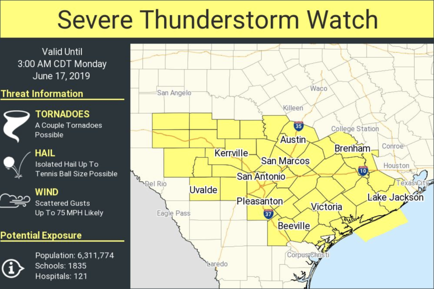
The National Weather Service has issued a severe thunderstorm watch for Austin and South Central Texas until 3 a.m.
The NWS says damaging winds, hail the size of tennis balls and tornadoes are possible.
RELATED | 8 Ways To Stay Ahead Of Severe Weather In Central Texas
As a reminder, a watch means there is the potential for severe weather. A warning means severe weather is imminent and residents should take immediate action to ensure their safety.
Northwestern Williamson and Burnet counties were under a severe weather advisory until 12:15 a.m. The NWS said penny-sized hail and 50-mph winds were possible. It said the storms brought torrential rainfall, which could lead to flooding.
Williamson County tweeted that up to 2 inches of rain had already fallen as of around 10:20 p.m. and that flash flooding was possible in the area.
The @NWSSanAntonio has issued an Urban & Small Stream Flood Advisory for Eastern WilCo until 1:15 a.m. Doppler radar indicated heavy rain due to thunderstorms; Up to 2" of rain have already fallen. Another round of storms are expected later tonight; could bring flash flooding. pic.twitter.com/5V5ihPYnnQ
— Preparing WilCo (@PreparingWilCo) June 17, 2019
Here's the latest from the National Weather Service's Austin/San Antonio office Twitter feed:


