This week, Google, already a leader in mapping, created more space between itself and its competitors by more deeply mining the data users provide the company when using its various services.
At the Google developers' conference in San Francisco on Wednesday, Daniel Graf, director of Google Maps, crowed about the company's mapping app for the iPhone — and couldn't quite stop himself from taking a dig at Apple.
"People called it sleek, simple, beautiful, and let's not forget, accurate," he said.
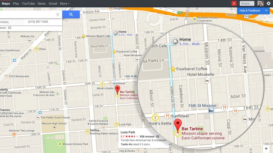
The company unveiled a new Google Maps with a number of new features: a clearer user interface; social recommendations; maps that are tailor-made for the searches and habits of an individual user; maps that highlight all the museums in a city after you search for one; maps that identify your favorite places and make them landmarks on the map that you see.
If you frequent a certain restaurant in San Francisco, for example, Google will take note and attempt to find similar places to highlight when you search for a restaurant in, say, Austin, Texas, or Prague.
When I opened up the new Google Maps on my computer, the first thing I saw in the upper left-hand corner were three pre-populated addresses: one was for my daughters' school, one was for our house (it was labeled "Home") and one was for the house we used to live in.
It is clear from the very first moment using the new Google Maps that this map is made just for me. But it also was another disconcerting reminder of how much information about me and my family is being captured and stored and analyzed by Google every day.

Over time, Google Maps will create local landmarks on my map — highlighting places I like to go. When I search for "coffee" in the search bar, Cafe Barrone, a place right next to our local bookstore, pops up prominently because we've searched for it in the past.
When Google revised its privacy policies last year — removing most of the barriers between its various services and clearing the way for the company to use data it collects about me in everything from search to my Google Calendar — it made services like its new maps possible. But it also meant that Google began creating hundreds of millions of individualized portfolios of information about its users that were capturing information about us in all sorts of ways.
"Generating new data from other data is fundamentally what Google does," said Brian McClendon, vice president of engineering at Google responsible for maps.
The mapping program, which for now is only available on desktops and laptops, also seamlessly incorporates images from Google Earth — without the need to download the Google Earth app. But this is only possible if you have a relatively new computer running the latest operating systems.
On a new, fast machine the results are gorgeous: As you scroll out and away from your neighborhood and rise up into the clouds, you see Earth as you would from space. Even the clouds are updated live and in real time. You can spin the globe and see the sun in the background, and you can watch the lights of cities on the dark side of the planet come on.
But not everyone will get this experience right away. When I booted the new Google Maps on my NPR laptop, the first thing I saw was a note letting me know that some of the slickest 3-D imagery wouldn't work.
If you want the full experience of 3-D maps, you need a current operating system — like Windows 7 or Windows 8. NPR, like many cost-conscious organizations, still has lots of laptops out in the field running Windows XP — including mine.
Copyright 2020 NPR. To see more, visit https://www.npr.org. 9(MDA3MzEzNjc2MDEzMDI2Mzc4OTc4NTFmNg001))


