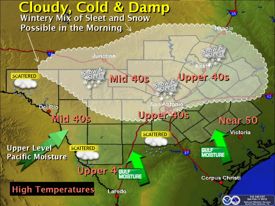
You may want to consider avoiding the roads tomorrow morning. The National Weather Service says a "wintry mix" of weather is in the forecast for much of Central and South Central Texas. The NWS says "no significant accumulations of ice or snow are expected" but that "model timing and precipitation amount uncertainties remain."
As a weakening upper level low ejects northeast into the region late tonight and Sunday, light rain will begin developing late tonight over the southern Edwards Plateau and Rio Grande Plains as Gulf moisture overruns a dry cold airmass. As temperatures continue dropping towards sunrise, some of the rain will become mixed with sleet. After sunrise, the overrunning precipitation will spread as the disturbance moves across the region. Atmospheric forecast profiles show relatively dry air near the surface across the Hill Country and over northern portions of South Central Texas at the time of subfreezing temperatures Sunday morning. Therefore, much of the Gulf moisture that overruns Sunday morning is expected to evaporate before reaching the ground, and no significant accumulations of ice or snow are expected at this time. As overrunning continues during the day, precipitation will become all rain by afternoon as temperatures rise above freezing. Model timing and precipitation amount uncertainties remain. Residents should stay tuned to later forecasts and statements on this potential wintry mix event Sunday morning.
Temperatures are expected to drop to 30 degrees tonight. Here's the full seven-day forecast.
If you do have to venture out on the roads, follow some of these tips AAA gave to the Newark Post.
- Slow down
- Use major routes
- Use low gear to get out of a tough spot
- Avoid slamming on the brakes
- Never use cruise control
- Do not drive in four-wheel drive
- Do not panic if your vehicle skids out of control
Remember that most of us in Texas have "summer tires" with harder treads that are not designed for icy conditions, so be extra careful while driving.


