-
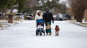 Travel is discouraged as accumulated sleet and freeing rain make roads, bridges and overpasses "extremely dangerous" and travel "near impossible in many areas."
 -
 The National Weather Service says the Austin area can expect freezing temperatures this weekend, along with wind chills in the single digits and the possibility of freezing rain or sleet.
 -
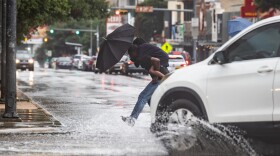 Chances of rain for the Austin area will be strongest Thursday.
 -
 National Weather Service meteorologist Harrison Tran said the best viewing conditions will be after sunset but before midnight.
 -
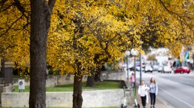 A cold front on Wednesday will bring morning temperatures down into the 60s and daytime highs in the low 90s.
 -
 The National Weather Service says runoff from excessive rainfall could cause flooding of rivers, creeks and low-lying areas.
 -
 A crisis communication expert says everyday notifications are weakening the impact of lifesaving emergency alerts.
 -
 The National Weather Service is warning of more flash flooding Sunday in areas already saturated from last weekend's deadly storms. The warning remains in effect until 3 p.m.
 -
 For years, employees say, they've had to do more with less. But the ability to fill in the gaps became strained to the breaking point when the Trump administration began pushing new staffing cuts.
 -
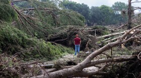
 A tornado touched down in Burnet County in the afternoon, the county's office of emergency management said.
© 2026 KUT Public Media
A service of the Moody College of Communication at the University of Texas at Austin
webmaster@kutx.org
A service of the Moody College of Communication at the University of Texas at Austin
webmaster@kutx.org
Play Live Radio
Next Up:
0:00
0:00
Available On Air Stations


