Loop 360, a major thoroughfare through the scenic hills of West Austin, is being expanded to increase traffic capacity in one of the most affluent and environmentally sensitive areas of the city.
The Texas Department of Transportation this week celebrated the start of construction on one of a handful of projects planned along the 14-mile stretch of highway.
"What’s being started here today is going to make things better," state Rep. Donna Howard, D-Austin, said in a statement. "It’s taking into account both safety and mobility."
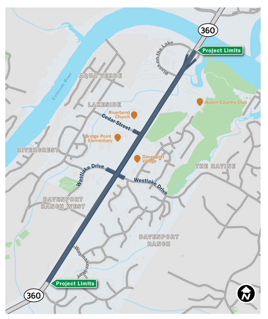
This particular effort spans about two miles along Loop 360, starting near the iconic Pennybacker Bridge and continuing south past some of the limestone rock walls that frame the highway. Crews will have to cut deeper into those walls to create space for the widened traffic corridor, which some nearby residents oppose.

The Loop 360 Project is focused on reconfiguring intersections so drivers won't have to stop at traffic lights. At Westlake Drive and Cedar Street, the 360 main lanes will pass under the cross streets.

The new layout includes northbound and southbound frontage roads with a turnaround lane at Westlake Drive. Outside the frontage roads, bicycle and pedestrian lanes — also known as shared-use paths — are planned for both sides of the highway.
Some neighbors fought against shared use paths, claiming not enough people would use them to justify cutting deeper into the signature rock walls along the highway.

"If we cut these rock cliffs for no really good reason, I think that would take away from the beauty of the city," said Krishan Malik, a longtime resident of Davenport Ranch, a community next to the highway. "I'm for the cyclists, but to have a lane that is hardly ever used is a waste of space."
His sentiment was echoed by neighbors in a 2019 record of public comments to TxDOT. Some people were concerned that shaving back the cliffs would put the precipice too close to homes.

Ultimately, TxDOT opted to keep the shared use path but slim down how much space it occupies near the rock walls.
On the east side of Loop 360, the path will be eight feet wide in some parts instead of 10. A 5-foot buffer zone between the pathway and cars was reduced to a 2-foot buffer next to the cliffs and the right turns at Westlake Drive.

Those changes frustrated advocates for cyclists and pedestrians who said the state agency was neglecting the safety of non-drivers.
"It's a transportation corridor. You need to make sure that you serve the different needs and you do so safely," said Tom Wald, the executive director of the Red Line Parkway Initiative who pressed the city and TxDOT not to reduce the width of the shared use path and buffer. "This is such a lost opportunity." Wald is also a City Council candidate in District 9.
For cyclists with the fortitude to travel in the 10-foot shoulder of the main lanes, there will be no options to cross the exit ramps. People on bicycles will be forced to exit on to the frontage roads, another concern for riders.

"[Drivers] are often stressed/distracted on these ramps, having to rapidly change lanes and make quick decisions," longtime West Austin resident Carl Langer told TxDOT. "The cyclist is safer simply waiting his or her turn and crossing the ramp, back to the safety of a wide shoulder where drivers 'next door' have their attention centered forward and are focused on freeway driving."
The $72.1 million project includes $14 million in funding from the City of Austin. The money is coming from a $720 million Mobility Bond authorized by voters in 2016.
City of Austin standards call for a minimum 10-foot shared-use path with a 5-foot buffer from the roadway.
"While all the proposed projects in the Loop 360 program include 10-foot [shared use paths] on at least one side of the corridor, TxDOT has cited the rolling terrain in this area as a challenge when it comes to meeting the design requirements of the bicycle and pedestrian facilities," Austin's Transportation Department said in a statement.
Bee Cave-based COPASA, Inc was hired to do the construction. TxDOT says the project is expected to take about three years to complete.


