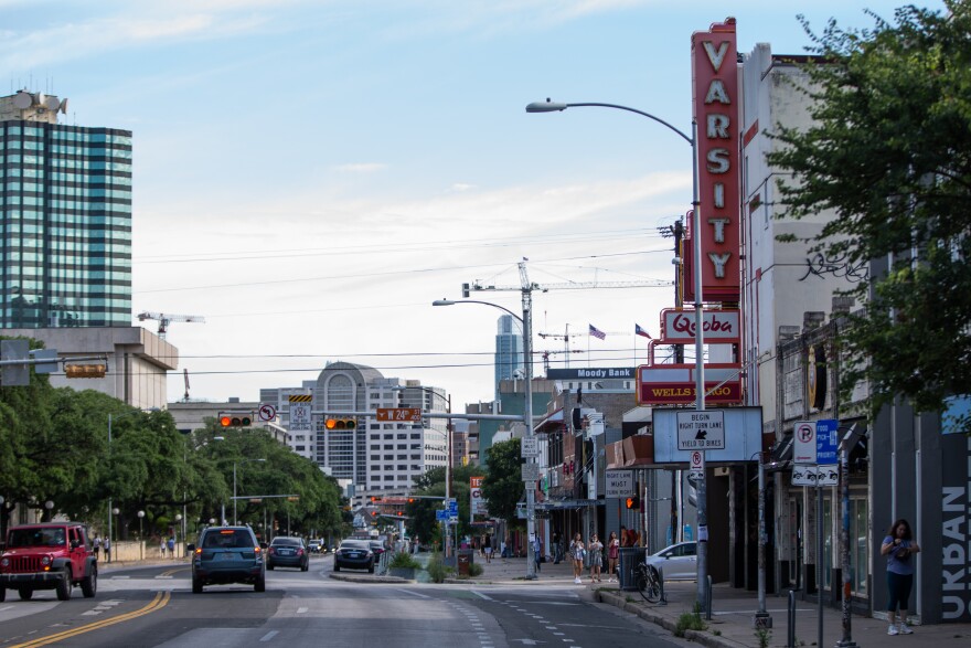
Car and truck traffic on Guadalupe Street near UT would be severely restricted or banned completely under a pair of competing light-rail scenarios unveiled this week.
The proposals are likely to raise concerns among drivers in a city where fewer than 4% of people commute to work via public transit, according to Census Bureau estimates.
But transit planners say reconfiguring the street to prioritize light-rail would move more than three times as many people per hour down the thoroughfare known as the Drag, bounded by Martin Luther King, Jr. Boulevard to the south and 27th Street to the north.

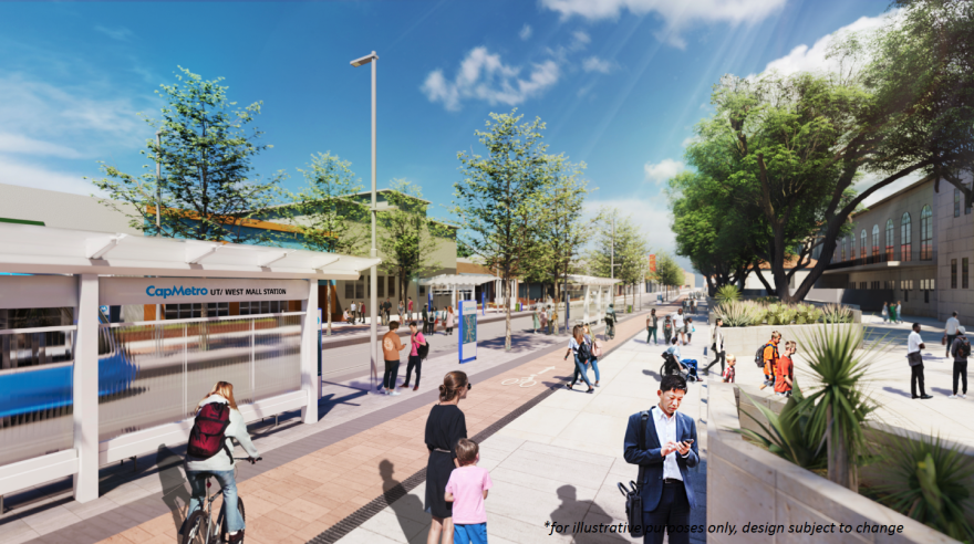
The proposals are also intended to make the Drag a more vibrant gathering place with the possibility of new public amenities like trees, benches, public art, secure bike parking, high-quality street lighting and space for outdoor cafes, pop-up shops and farmers markets.
The light-rail plans are a key feature of the $7.1 billion transit expansion voters approved in November 2020 by authorizing a tax increase of 8.75 cents per $100 of property value. The project is being overseen by a local government corporation called the Austin Transit Partnership (ATP).

The railway down Guadalupe Street would serve both the Blue Line, which will start at Austin-Bergstrom International Airport, and the Orange Line, originating from Stassney Lane near South Congress. Both lines will terminate at the North Lamar Transit Center, although there are long-range plans to extend the Orange Line in both directions.
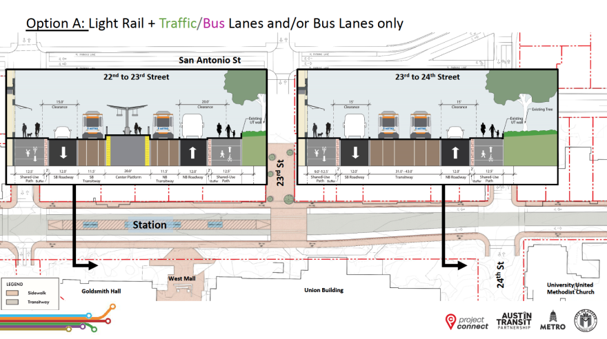
The first of two visions presented by the ATP, dubbed Option A, would reduce traffic to one lane in each direction. The lanes could be open to general purpose traffic or restricted only to buses. Pedestrians and cyclists would share a sidewalk between 9 and 14 feet wide, depending on the location along the Drag.

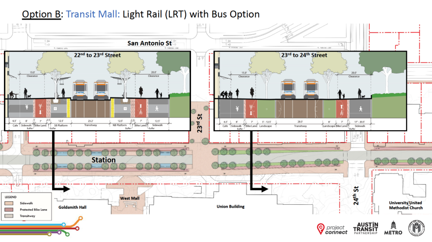
Option B, also known as the transit mall option, would eliminate traffic lanes but leave open the possibility of buses operating on the street, possibly on the light-rail path, according to ATP consultant Jerry Smiley with the engineering company AECOM.
Earlier this week, however, ATP chief designer Peter Mullan said it would be undesirable for trains to share a guideway with buses on a transit bridge planned to cross Lady Bird Lake.
Option B would include 7-foot-wide dedicated bicycle lanes and sidewalks anywhere from 7.5 feet to 27.5 feet wide, again depending on where and which side of the street.

The light-rail station would be located between 22nd and 23rd streets, right where UT's West Mall opens into the street.
The Drag right now has a "throughput" of almost 6,500 people per hour that would increase to 19,250 people per hour under option A, Smiley said. Option B would raise the throughput even higher to 21,160 people per hour, but would require "getting people out of their single-occupant vehicles and moving them into a different mode" of transportation, he said.
Drivers who rely on Guadalupe as a commuter path would have to "find another route," Smiley said. A presentation of traffic modeling did not show how that could affect driver commute times or traffic congestion on nearby streets.
If Capital Metro buses are prevented from using the Drag, they might operate on West Campus side streets like San Antonio and Nueces.
"The bus network is flexible. We can make those adaptions where we need to," Smiley said.
The plans also call for improving alleyways behind businesses on the Drag so they could be used to deliver products to retailers and restaurants. That would require coordination with business owners and the Austin Transportation Department.

ATP is incorporating public feedback into a draft environmental impact statement, early designs and preliminary cost estimates. The agency lists public meetings on the Project Connect website and also accepts feedback by email.


